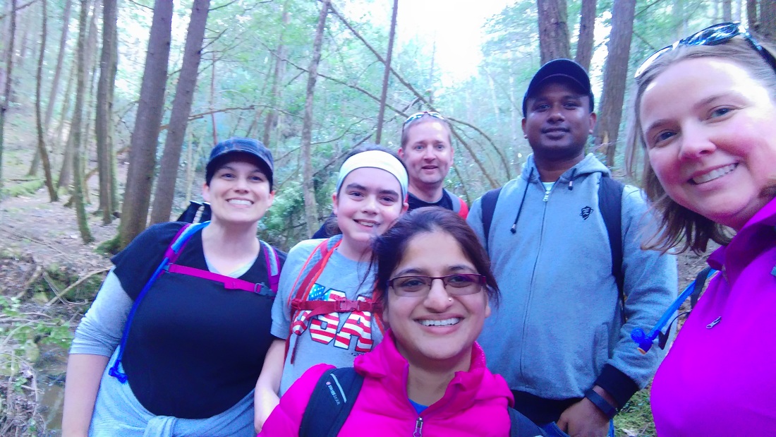
 Lisa, Ben, Kent, Minakshi, Faruk, and me at the trail head. | My hiking buddy, Lisa, and I pushed to maintain our pace with this trip, week 8 in a row of hiking! This one was a challenge and definitely the most "remote" we've done this year. But, bonus, we got a bunch of really awesome people to go along with us. It was a big group, but also some big miles! |
On tap for this week:
Yes, I knew it was going to be a challenge when our driving directions consisted of following Forest Roads that were either numbered or named and Goggle Maps couldn't follow either. But that's ok. That's why it's called an adventure!
All good plans come from a wonderful book. In this case, it's Day and Overnight Hikes: Kentucky's Sheltowee Trace by Johnny Molloy. It's been great so far with constructing ideas for how to go about hiking the Sheltowee Trace. I like that it splits the Trace apart into small bites, and focuses on the best bits. The anal-retentive part of me wants to see more links to the section numbers provided by the Forest Service for the Trace, so I know exactly which ones we've marked off the list.
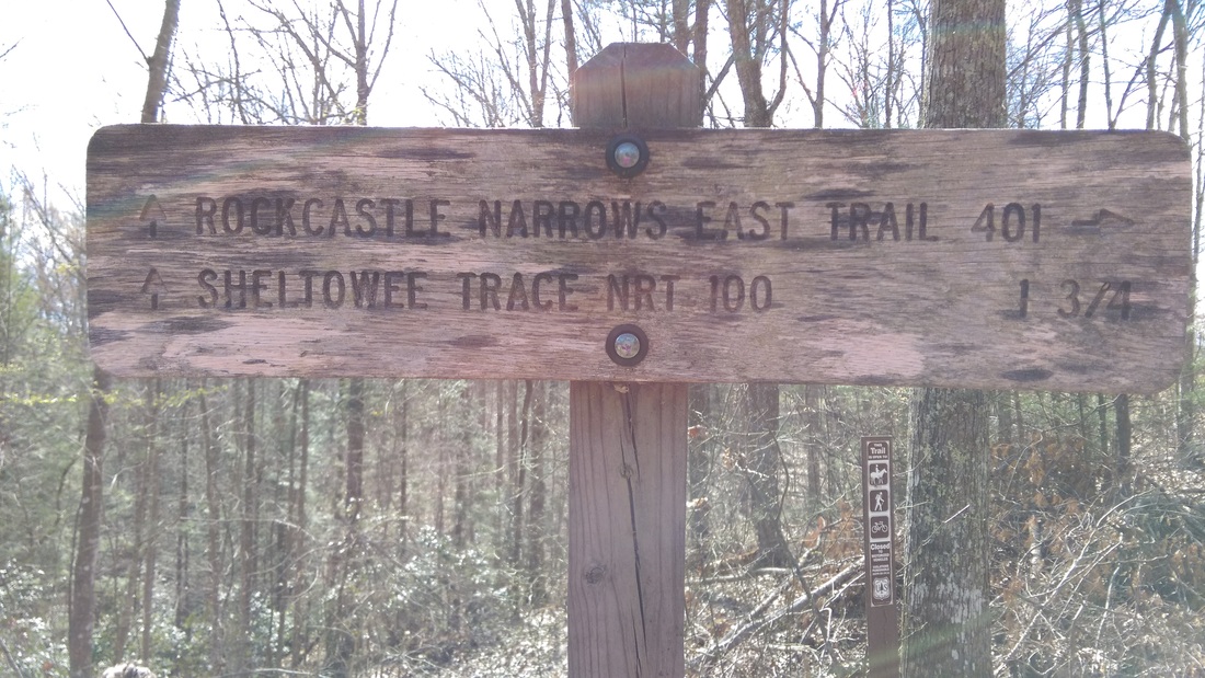
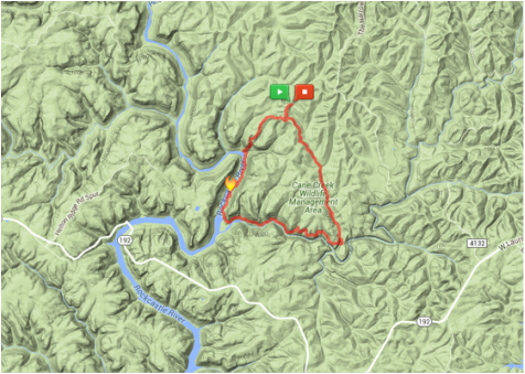
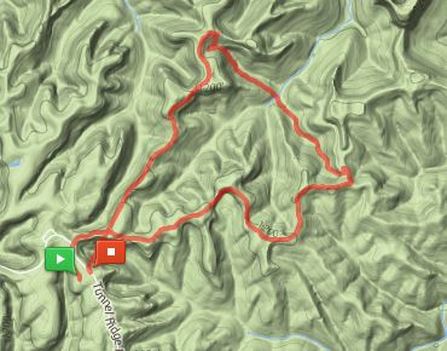
- Rockcastle Narrows East Trail (#401) - a loop with Van Hook Falls!
- Sheltowee Trace Trail (#100) - the Kentucky long trail, or at least, a small section of it... miles 88.30 to 89.43 northbound following The "Thru-Hiker's Manual" for the Sheltowee Trace by Scot "Taba" Ward. Section #25.
- 7 mile loop!
Yes, I knew it was going to be a challenge when our driving directions consisted of following Forest Roads that were either numbered or named and Goggle Maps couldn't follow either. But that's ok. That's why it's called an adventure!
All good plans come from a wonderful book. In this case, it's Day and Overnight Hikes: Kentucky's Sheltowee Trace by Johnny Molloy. It's been great so far with constructing ideas for how to go about hiking the Sheltowee Trace. I like that it splits the Trace apart into small bites, and focuses on the best bits. The anal-retentive part of me wants to see more links to the section numbers provided by the Forest Service for the Trace, so I know exactly which ones we've marked off the list.
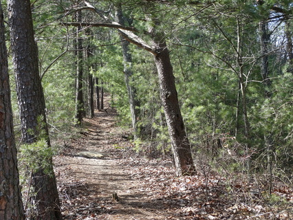
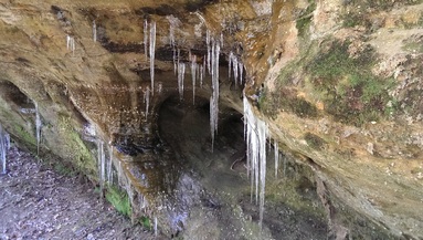
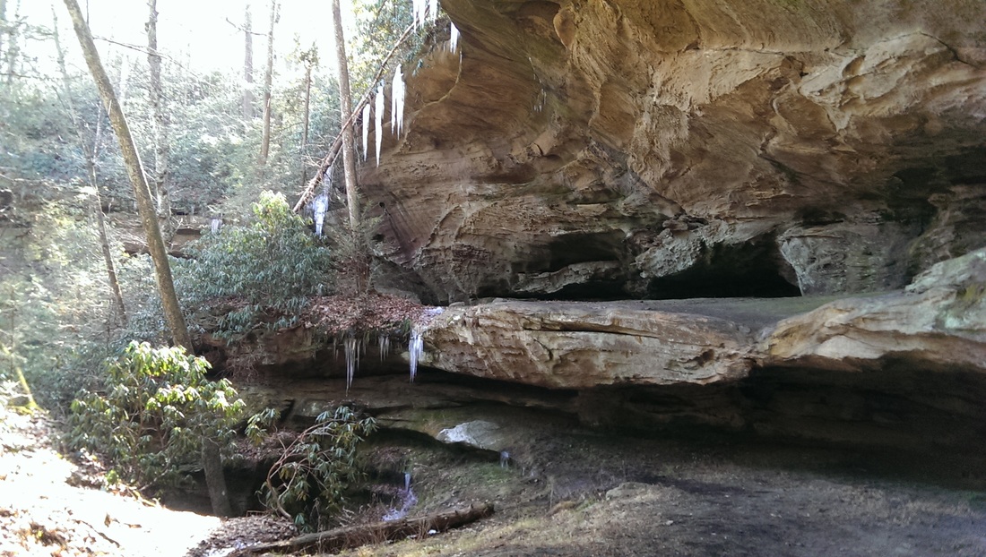
 We parked off KY 119 and walked down past the gate to the trail head. It's a beautiful tree-lined trail, following down Yuel Branch to Van Hook Branch creeks. On the way down to Van Hook Falls, we ran across a couple of small falls and lots of rock shelters. The days was amazing, though in places the trail was muddy and wet. But that's ok! It still made for a nice hike! | 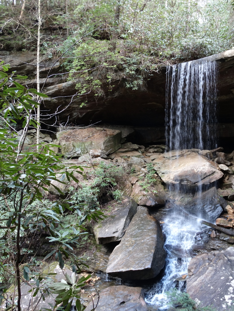 Van Hook Falls, KY |
The first leg of the hike took us down to the connection with the Sheltowee Trace. It was easy enough following the diamond blaze ("blaze or not a blaze?" or "moss or blaze?" anyone?), but once on the Trace, it's the white turtle blaze that can be spotted without difficulty. The two trails overlap for about a mile, splitting at the turn off for Van Hook Falls, which the Trace goes down past while the Narrows East turns right to follow the Cane Creek Gorge, which you'll hear, but not see for a long bit.
The downhill to Van Hook Falls was easy enough. Let me tell you, the falls itself was beautiful! We had it all alone too. No one to disrupt the view but each other. Don't worry, we did too. There was a lot of picture taking and an adventurous Lisa leaned her head back into the falls to get her head wet. Said it was super cold! That's not for me though, I preferred to stand back and take some pictures. Faruk took advantage and posed while I was trying to take some nice distance shots of the waterfall. Ruin the picture? I'm not sure. Right now, it's making me laugh.
The downhill to Van Hook Falls was easy enough. Let me tell you, the falls itself was beautiful! We had it all alone too. No one to disrupt the view but each other. Don't worry, we did too. There was a lot of picture taking and an adventurous Lisa leaned her head back into the falls to get her head wet. Said it was super cold! That's not for me though, I preferred to stand back and take some pictures. Faruk took advantage and posed while I was trying to take some nice distance shots of the waterfall. Ruin the picture? I'm not sure. Right now, it's making me laugh.
Backtracking to the trail and following the Cane Creek, we came upon the Boulder Garden, huge rock boulders spread long the creek basin. Mind you, these weren't as impressive as the ones I've seen at Red River Gorge, but, they aren't bad. I didn't get any pictures though.
| Right when you are able to see the Cane Creek, the trail turns back north and follows part of Lake Cumberland up to the Narrows. While you are suppose to see where Winding Stair Gap Trail comes in, we didn't notice the junction. | 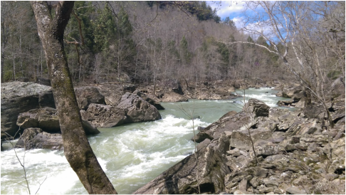 Rockcastle Narrows rapids |
It may have been there, but in a busy day of hiking and laughing, it didn't make much of an impression. When we were there, people were camping on the sandy beaches and enjoying the Lake. I can't blame them, it was a beautiful day to be outside and enjoying the weather. Camping out on the beach? I'm not sure that's a good idea. We opted for a bite of lunch up in the boulders instead. Need to stop and use the little Boulder's Room too while we're here?
The trail follows Lake Cumberland up to The Narrows, where the Rockcastle River narrows, creating some beautiful rapids. The Narrows provide Class III rapids open to kayaking. Don't worry, we didn't do any kayaking, but we did go down and stick our tired feet in the cold water. Leave it to fearless Lisa to go all in with both feet, then slack around and have a nap.
The trail follows Lake Cumberland up to The Narrows, where the Rockcastle River narrows, creating some beautiful rapids. The Narrows provide Class III rapids open to kayaking. Don't worry, we didn't do any kayaking, but we did go down and stick our tired feet in the cold water. Leave it to fearless Lisa to go all in with both feet, then slack around and have a nap.
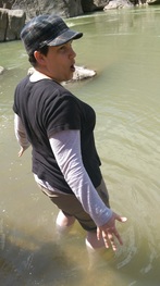 Lisa sticking her feet into the Rockcastle River | 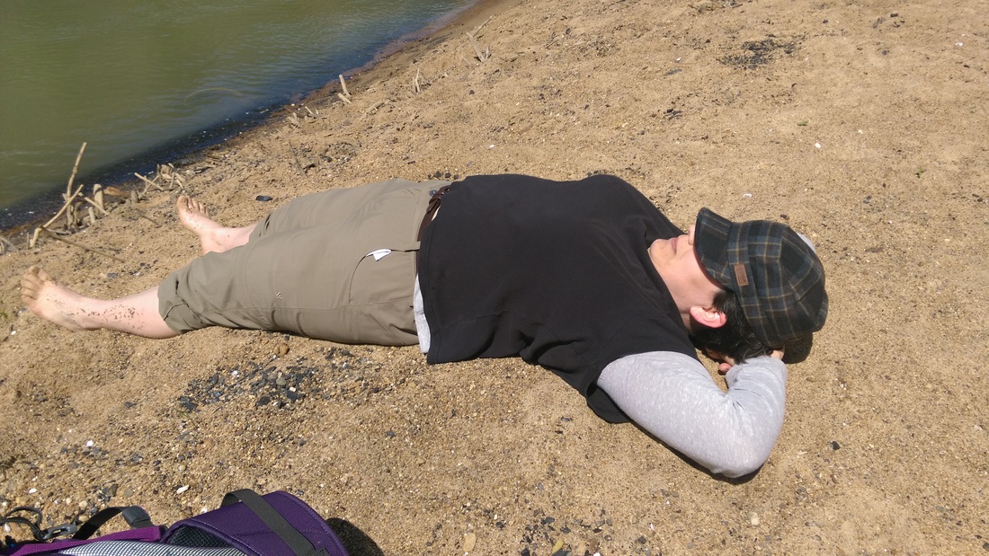 Lisa grabbing a couple of winks while we put our shoes back on |
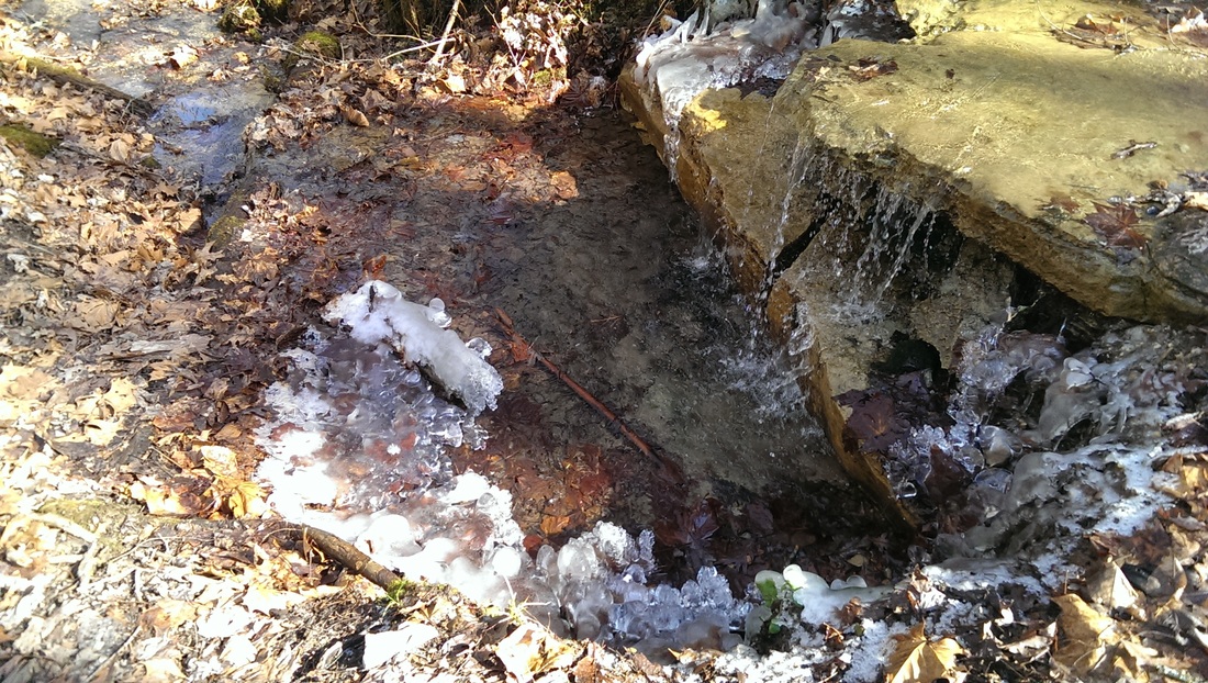
Working our way back to the car, we came upon a wonderful set of switchbacks, looping back and forth through the forest. At one point it became no more than a drainage ditch. This was ok, until we had a hard time determining if the trail stayed in the ditch or ventured off into a rock shelter. Lisa decided to be adventurous and follow the ditch downhill, the rest of us kept with the rock shelter and walked across a cute little waterfall in the shelter. It wasn't long past the waterfall when we were able to stop the blaze again, but we couldn't spot Lisa.
Ah, what to do!
"Marco!"
"Polo!"
"Blaze!"
Smash, smash, smash. "Crap!"
Yup. Old fashioned, but highly effective tracking. Ben was bounding forward with the rest of the group, while I'm handing back a bit to make sure Lisa could find her way back to us. It was a joy.
The hike back to the car was uphill. It didn't feel long, it was just uphill. I don't do uphill well. Give me flatland or give me death. That's ok, my buddy Ben likes to stop and rest a bunch too.
Lisa's decided I should spend my time chronicling the Trace in detail, maybe write an updated hikers guide. We'll see. I want start connecting some of the random pieces of trail that we've done together before I think that far ahead! What do you think?

 RSS Feed
